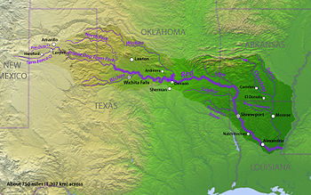
An 1818 map was used to negotiate a boundary treaty between the United States and Spain, then Mexico, then the Republic of Texas, then the State of Texas. The only problem was, the map was wrong! Learn about a boundary dispute between Texas and Oklahoma that made it to the U.S. Supreme Court and beyond!

Podcast: Play in new window | Download

Recent Comments